When you are buying a home, you want to get along with your neighbors. But even when you move in next to your new best friend, sometimes fences just have to be put up between you. If you want to stay friends, it’s a great idea to know exactly where that physical fence should go before you destroy more than a bit of ground cover. Legal disputes between neighbors over property boundaries can be disastrous, both in creating unpleasant living conditions and the financial drain with ongoing action. Unfortunately, it can happen, even states need to be certain of their boundary lines. Even Florida and Georgia once had a dispute over territory.

What is a Boundary Line?
Whether you’re looking at putting up a nice decorative fence or getting a professional in to build a solid brick wall, you will need to know where your boundary line is. Way back in the days when your property was just an empty piece of land an official boundary survey was lodged to define the exact location of your property (and your neighbors). On your title of deed, there is a layout of your land with any easements marked. So, your boundary line is simply the official edge of your property.
Is That Really My Property Boundary?

Over time property boundaries can appear to move. A tree bordering the property grows, a fence gets built on one side of it, and slowly with each rebuild the fence encroaches more and more onto your property. Or maybe no one really knew where the boundary was, and someone just made an arbitrary decision and popped a dividing line up where they wanted.
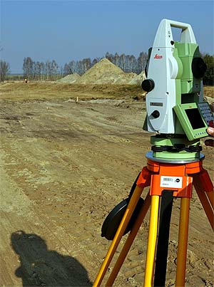
Before you build anything on your property it is an excellent idea to speak to a land and survey specialist from land surveying companies like Landtec Surveying, Inc. and arrange to have your property surveyed. Do this sooner rather than later, because you do not want to have to move that new pool, garage, or fence after your neighbor has discovered that you have actually built two feet onto their property.
How Do Boundary Surveys Work?
A professional survey is not simply a case of looking at Google Maps to decide where a property’s boundaries are. A surveyor may go through historical records to look at the original purchase agreement and that of the neighboring properties to establish what should have been the original plot dimensions and land allowances. They may also look at the physical layout of the property and where natural landmarks sit. Property boundaries are often created along natural lines.
Other Survey Types
Although most people think of surveys as being the process of working out the boundary of the land and formalizing the size and shape of the plot, there are several other types of surveys that are required to be undertaken for different purposes. Generally, a boundary survey is required for defining a legal area, but for any building or changes to land (excavation or building up areas), you will need to talk to your surveyor about what exactly you need.
Topographical Survey
Part of a land survey may be to create a topographical survey. This is where the surveyor maps the elevation of the land as contour lines on a plot – showing any natural features of the land like streams or swamps, as well as hills, valleys, and gradients. A topographical survey will be needed if you are looking at any building work, without this information an architect or builder will not be able to create accurate plans. This may cost you significant amounts of money in the long run if you need to make adjustments.
As-Build / Record Survey
Generally, these are undertaken at the finalization of the building process when the building differs from the original plan. This may include when walls have been altered, added, or moved. A map is created that shows the position of any and all buildings, as well as fences, manholes, power substations, water valves, etc.
Hydrographic Survey

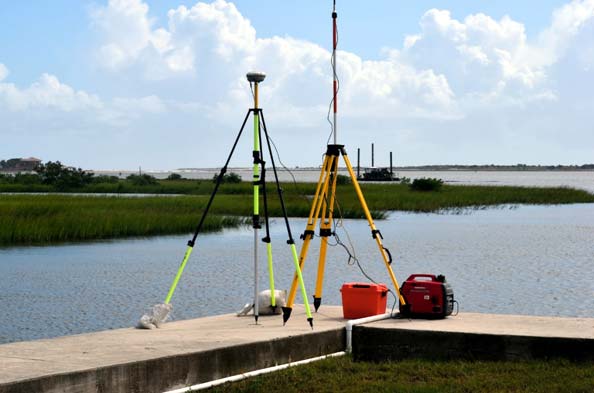
This type of survey is focused solely on the water – and may include not only the location of any body of water but also the depth, direction of flow (particularly in the case of a stream), and strength of the current. If the body of water is tidal or seasonal, as with swamp land or flood-prone land, this information may also be included.
There are additional types of surveys available, but these are the main ones that may be required for standard residential use.
Property Line Disputes
You may be experiencing a property dispute. Each state has differing legislation around dispute resolution and property owner responsibility. For example, in some
It is important to know where your boundary line is, even if you’re not selling your home. You want to know about any easements that give another person access to any part of your land. This may mean that someone has the right to walk over your land to access a waterway, or a shared accessway to another property. In this instance, you do not have the right to prevent their access by building a fence or gate.
The regulations around how close to the boundary line you can actually build a fence also vary from state to state. So check with a local expert to learn more about your situation.
Is A Boundary Survey Compulsory?

Although this varies according to which state you are living. In most states, there is no legal obligation to have a boundary survey of the title completed. However, if you are obtaining a mortgage in order to purchase the property, your lender may require a survey to be completed. Generally, it will be the purchaser who has to pay for this survey to be completed by a qualified surveyor. First time homebuyers should review these tips to better understand what will happen as they move forward.


